Development of road, rail, water and air routes
The transport system is considered the lifeline of the country, and it is the primary goal of both the state and the centre.
There are three major means of transport
- Land (Roadways, Pipelines, Railways),
- Water (Inland, Waterways, Ocean Routes),
- Air (Domestic, International).
This article discusses transport in India and the development of roads, rail, water, and air routes.
Development of transport in India
India has good transport Infrastructure such as roads, railways, airways, and waterways.
Road Infrastructure in India
An important mode of transport for goods and passengers for short, medium, and long distances. The road is easy, and cheap to construct, build and maintain.
Asia’s largest tunnel is Patnitop Tunnel. It is also India’s longest road tunnel with a length of 9.28 km (5.8 mi), and the country’s first tunnel with a fully integrated tunnel control system.
India has the second-longest road network with a total length of 56,03,293 Km as of 2016. About 85% of passengers and 70% of freight traffic are carried out every year.
The road network in India is classified based on the purpose of construction, maintenance, etc., into National Highways (NH), State Highways (SH), District Roads, Rural Roads (Village Roads), Border Roads, and International Highways.
1. National Highways (NH)
- These highways connect the capitals of states, major ports, rail junctions, and industrial and tourist centres.
- The Ministry of Road Transport and Highways of India is responsible for the development and maintenance of the National Highways in India. The total length is 1,01,011 km, which is 1.8% of the total road network in 2016.
- The longest National Highway is NH-7, which runs from Varanasi in UP to Kanniyakumari in TN, covering a distance of 2369 km.
- The shortest National Highway in India is NH-47A, which runs from Ernakulum to Kochi Port (Willington Island) covering a distance of 6km. The total number of national highways in India is 200.
2. State Highways (SH)
- SH are roads that connect important cities, towns, and district headquarters within the state and connect them with the National highways or Highways of neighbouring states.
- These roads are financed and administered by the State government. State Highway runs to a length of 1,76,166 km as of 2016.
3. District Road
- District roads connect the district and taluk headquarters with the state highway and national highways.
- District roads are constructed and maintained by the Public Works Department of the state and the Zila Parishad. The total length of the district road is 5,61,940 km (16.81%) in 2016.
4. Rural Road
- This connects different villages with neighbouring towns. Maintained by Village Panchayats. The total length is 39,35,337 Km as of 2016.
- Rural roads consist of Panchayat roads ( Zilla Parishad, Panchayat Samiti, Gram Panchayat); roads of the Pradhan Mantri Gram Sadak Yojana (PMGSY), and those constructed by the state PWDs.
5. Border Roads
- These roads are of strategic importance and are constructed and maintained by Border Road Organisation (BRO).
- BRO was established in 1960, for the development of roads of strategic importance in the Northern and Northeastern Border areas.
- BRO has constructed the world’s highest road joining Chandigarh and Leh in Ladakh. Border road runs at an average altitude of 4270 meters.
6. Expressways
- Expressways are multi-lane, good-quality highways for high-speed traffic.
- Important expressways are Mumbai-Pune Road, Kolkata-Dumdum Airport Road, Durgapur-Kolkata Road, and Yamuna Expressway between Delhi and Agra.
7. International Highway
- It links India with neighbouring countries for the promotion of harmonious relationships with them.
- These highways are constructed with aid from the World Bank under an agreement with the Economic and Social Commission for Asia-Pacific (ESCAP).
- These highways connect India with Pakistan, Nepal, Bhutan, Bangladesh, and Myanmar.
- In India, the densest road network is found in the northern plains, where it is relatively easy to construct roads. In the mountainous areas, it is difficult to construct roads. Road density is highest in Kerala and lowest in Jammu & Kashmir.
- The total number of national highways in India is 6, they run from Moreh in Manipur, India, to Maesot in Thailand via Myanmar’s Tamu, Mandalay, and Myawaddy.
- Shershah suri built the Shahi (Royal) road, from the Indus Valley to Sonar Valley in Bengal. This road from Kolkata to Peshawar was renamed the Grand Trunk(GT) road during the British era. At present, it extends from Amritsar to Kolkata, and it is bifurcated into two segments: NH-1 from Delhi to Amritsar and NH-2 from Delhi to Kolkata.
National Highway Authority of India (NHAI), established in 1995. It is an autonomous body under the Ministry of Surface Transport
Tamil State board books
Golden Quadrilateral: Also referred to as the golden highway of India, that extends about 5,846 km long road of 4/6 lanes connecting India’s four metropolitan cities: Delhi, Kolkata, Chennai, and Mumbai, was launched in 1999.
North-South and East-West Corridors: The North-South corridor aims at connecting Srinagar in Jammu and Kashmir with Kanyakumari in Tamil Nadu (including Kochi-Salem Spur) with a 4,076 km long road.
The East-West corridor has been planned to connect Silchar in Assam with the port town of Porbandar in Gujarat, with 3,640km of road length. The two corridors intersect at Jhansi.
Railway Infrastructure in India (Railway infrastructure upsc)
Railways are considered the backbone of the surface transportation system of India. Indian Railways network is the largest in Asia and the second-largest in the world.
Length is 67,368 km with 7349 railway stations as of 2017. The history of rail transport in India started 160 years ago, when the first passenger train ran between Bori Bunder (Bombay) and Thane, a distance of 34 km.
The highest-speed train in India is the Gatimaan Express.
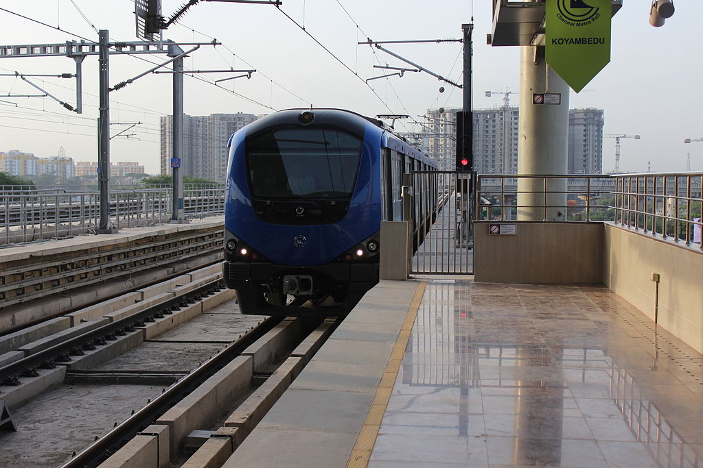
The light rail system in India is a type of city train public transportation that generally has a lower seating capacity and lower speed than heavy rail. It is called MRTS or Metro Trains in India, or Urban Rail Transit in India. An example is Chennai Metro, Chennai MRTS, etc.
Importance of rail transport in India
It is considered the cheapest and fastest means of Public Transport for the general public, and it is a lifeline for a country like India, where the Land is huge, with tough terrains.
Generally, rail transport is considered the safest means of transport.
The development of rail transport in India is done by the Indian Railways. For ease of operation and management, the Indian Railways is organised into 16 zones (railway zones in India UPSC).
- Northern Railway – Delhi,
- North-Western Railway – Jaipur,
- North-Central Railway- Allahabad,
- North-Eastern Railway – Gorakhpur,
- North-East Frontier Railway – Guwahati,
- Eastern Railway – Kolkata,
- East Coast Railway – Bhubaneswar,
- East-Central Railway – Hazipur
- West-Central Railway – Jabalpur
- Central Railway – Mumbai (VT)
- Western Railway-Mumbai (Churchgate)
- Southern Railway – Chennai
- South-Central Railway – Secunderabad
- South-Eastern Railway – Kolkata
- South-Western Railway – Hubball
- South East Central Railway – Bilaspur
The Northern Railway accounts for the longest route length, followed by the Western Railway.
On the basis of the track, the Indian railway’s categories are Broad Gauge with a width of 1.676 meters, Meter Gauge with a width of 1 meter, Narrow gauge with a width of 0.762 meters, and light gauge with 0.610 meters.
The arrival of Konkan Railways Corporation (KRC), Mass Rapid Transit System (MRTS), Metro, and Sub-Urban railways give easy means of transport.
a) Konkan Railway
The construction of Konkan Railways was completed in 1998. It connects Roha in Maharashtra to Mangaluru in Karnataka over a length of 760km.
On its routes, the railway crosses 146 rivers and streams, nearly 2000 bridges, and 73 tunnels. Asia’s longest tunnel is nearly 6.44 km long on this route.
The states of Maharashtra, Goa, and Karnataka are partners in this undertaking. The rail link between Banihal in the Jammu region and Qazigund in the Kashmir valley was opened in 2013; this rail passes under the Pir Panjal Range through an 11.2 km long tunnel.
b) Metro Railway in India
- 8 cities with Metro rail in India.
- Kolkata, Chennai, Delhi, Bengaluru, Gurgaon, Mumbai, Jaipur, and Kochi.
- Kolkata is the first city in India to have a metro rail, also called the Mass Rapid Transit System (MRTS).
- As of September 2018, India has 507 km of operational metro lines and 381 stations.
“The state of Meghalaya has no railway network“
The first train in India was from Mumbai to Thane in 1853, covering a distance of 34 km. In 1951, the railway was nationalised as one unit “
“The Indian Railways is headquartered in New Delhi.”
“The first suburban railway started in 1925 in Mumbai.”
“Chennai becomes the 6th Indian city with the metro railway.”
“Gatiman Express is the fastest operational train in India, which connects New Delhi and Agra and touches 160 km/h. This train takes a travel time of 105 minutes to cover a 200 km journey.”
Pipeline Transport in India
The pipeline is a convenient mode of transport for oil and natural gas fields, refineries, and markets. Also used to transport water.
The initial cost of laying the pipeline is high, but the maintenance cost is less. Its advantages are a steady supply of goods and reduced transhipment losses and delays.
Important networks of pipeline transportation in India are:
Oil field in upper Assam to Kanpur, from Salaya in Gujarat to Jalandhar in Punjab, and a gas pipeline from Hazira in Gujarat to Jagadispur in Uttar Pradesh
Water Transport System in India
It is a fuel-efficient and eco-friendly mode of transport. The oldest and cheapest mode of transport.
Two types of waterways are Inland Waterways and Ocean Waterways (see routes)
History of water transport in India
Although India has been using water transport for thousands of years, officially, the Inland Waterways Authority of India (IWAI) came into existence on 27 October 1986 to improve and develop Inland water transport.
Inland Waterways in India
India has an extensive network of inland waterways in the form of rivers, canals, lakes, and backwaters.
The total navigable length in India is 14,500 km, out of which 5200 km of rivers and 4000 km length of canals are used by mechanised crafts.
The total cargo carried by inland waterways is just about 0.1% of the total inland traffic in India. The Inland Waterways Authority was set up in 1986.
The Major national waterways are :
National Waterway 1: Between Haldia and Allahabad measures 1620 km and includes stretches of the Ganga-Bhagirathi- Hooghly river system. It is the longest national waterway in India.
National Waterway 2: a stretch of the Brahmaputra River between Dhubri and Sadiya, a distance of 891 km.
National Waterway 3: extends between Kollam and Kottapuram in Kerala, it is the first national waterway in the country with 24-hour navigation facilities along its entire stretch of 205 km.
National Waterway 57 Operationalised. In a major step towards reviving Assam's river based trade and promoting sustainable logistics, National Waterway 57 (River Kopili) has been operationalised on August 2 2025.

Inland waterways Authority of India (IWAI) has been actively working to unlock the navigational potential of rivers across the Northeast

Ref: Economic Times
Oceanic Routes
About 95% of India’s foreign trade by volume and 70% by value moves by ocean routes. There are 13 major and 200 minor or intermediate ports in India.
The major ports are administered by the central government, and minor ports are managed by various state governments.
The major ports on the east coast are Kolkata (including Haldia Dock), Paradip, Visakhapatnam, Chennai, Ennore, and Tuticorin.
The major ports on the west coast are Kandla, Mumbai, Nhava Seva (Jawaharlal Nehru Port), New Mangalore, Marmagao, and Kochi.
India has four major shipyards: the Hindustan Shipyard in Vishakhapatnam, the Garden Reach workshop in Kolkatta, Mazagaon Dock in Mumbai, and Kochi Shipyard in Kochi.
India is the second-largest ship-owning country in Asia and 16th in the world.
Air Transport in India
Air transport in India started on 18th February 1918, when Henry Piquet carried mail from Allahabad to Naini. In 1953, eight different airlines operating in India were nationalised.
Domestic airways fly within the country, and international airways connect major cities of the world. Indian Airlines and Air India are the two airline services run by the Indian Government.
Indian Airlines provides domestic air services, and Air India provides international air services. At present, there are 19 designated international airports.
These airports are managed by the Airport Authority of India,
Examples: Netaji Subhash Chandra Bose International Airport, Kolkata, Chennai International Airport, Chennai, Indira Gandhi International Airport, Delhi, Chhatrapati Shivaji International Airport, Mumbai, etc
There are 80 domestic airports and 25 civil enclaves at defence airfields.
Pavan-Hans Helicopter Ltd
Pavan-Hans Helicopter Ltd provides Helicopter support to the petroleum sector, such as ONGC and Oil India Ltd.
It is a public sector company based in New Delhi. Its operation is based at the Juhu Aerodrome in Vile Parle (West), Mumbai.
Pavan-Hans is a Mini Ratna-I category public sector undertaking. It also provides services to state governments in India, particularly North East India, Inter-Island Ferry Services in Andaman & Nicobar Islands, services to Lakshadweep Island, etc.
Airport Authority of India (AAI)
Constituted in 1995
It provides security to Indian Airports.
AAI, under the Ministry of Civil Aviation, is responsible for creating, upgrading, maintaining, and managing civil aviation infrastructure in India.
Transport in India geography project pdf
Transport in India in the latest news
2025
- PM Modi inaugurated the Vizhinjam International Seaport (VIS) in Kerala. It is India’s first deep-water transhipment port. It handles containers and multi-purpose cargo. This port is developed under a Public-Private Partnership.
- PM Modi inaugurated the Chenab Bridge and Anji Bridge on the USBRL Project in Jammu and Kashmir. The Chenab Raid Bridge is the World’s highest railway arch bridge, standing 359 metres above the riverbed. Whereas Anji Khad Bridge is India’s first cable-stayed railway bridge, built over the Anji River, a tributary of the Chenab.
- AIZAWL joins the rail network. Mizoram’s capital, Aizawl, is now connected to the national railway network via the Bairabi-Sairang line, making it the fourth North-East state capital with rail connectivity after Guwahati, Agartala and Itanagar.
- Indian Railways has successfully tested its first hydrogen-powered coach at the Integral Coach Factory (ICF) in Chennai.
- Sagarmala Finance Corporation Limited – The Ministry of Ports, Shipping & Waterways (MoPSW) inaugurated SMFCL, India’s first NBFC dedicated to the maritime sector.
- Rudrastra (India’s longest Freight Train) – On August 7, Indian Railways successfully operated “Rudrastra”, a long freight train created by combining six empty BOXN rakes, from Ganjkhwaja station under the Pandit Deen Dayal Upadhyay (DDU) division. The train measures approximately 4.5 km with 345 wagons, and it is the longest freight train ever operated by Indian Railways. It uses seven engines.
- The Ministry of Ports, Shipping and Waterways has inducted India’s third Very Large Gas Carrier (VLGC), Shivalik, under the Indian flag at Visakhapatnam Port.
- On December 7 2025, Shyok Tunnel was inaugurated, which is a project of Border Roads Organisation (BRO). Shyok tunnel is a 920-metre cut-and-cover tunnel on the 255 km-long Durbuk-Shyok-Daulat Beg Oldie (DS-DBO) Road, which runs along the Line of Actual Control (LAC) in eastern Ladakh.
good content. helped my project.