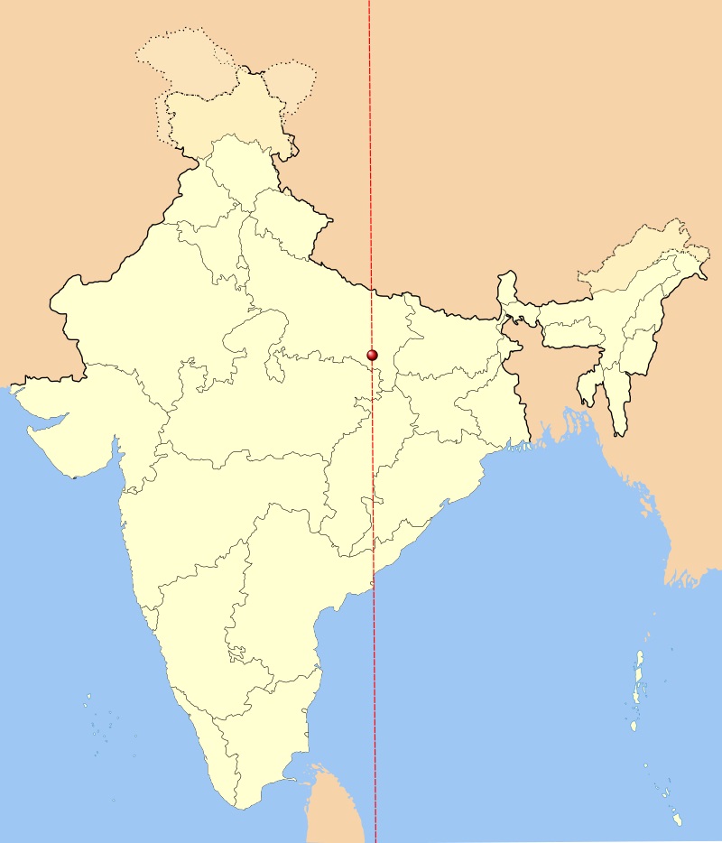
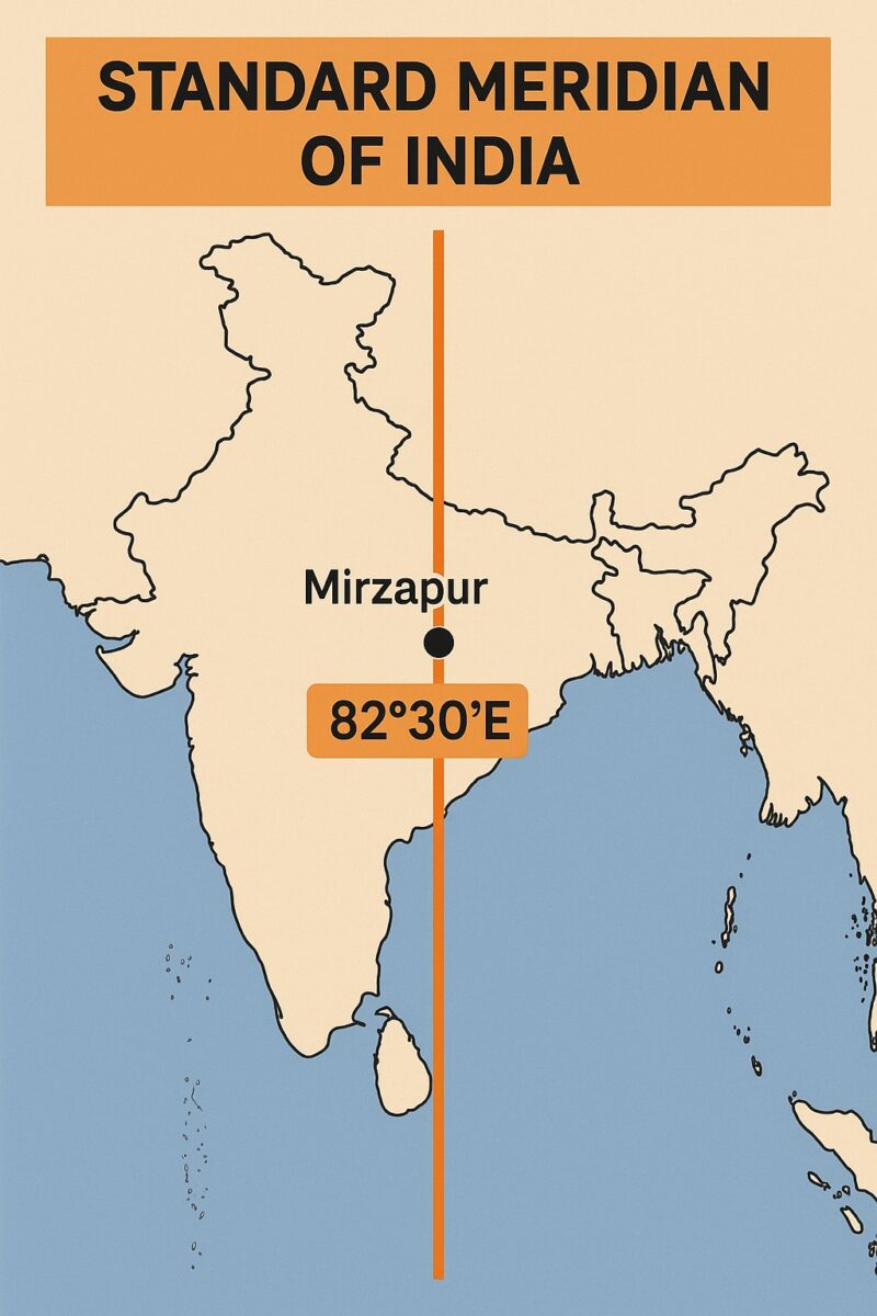
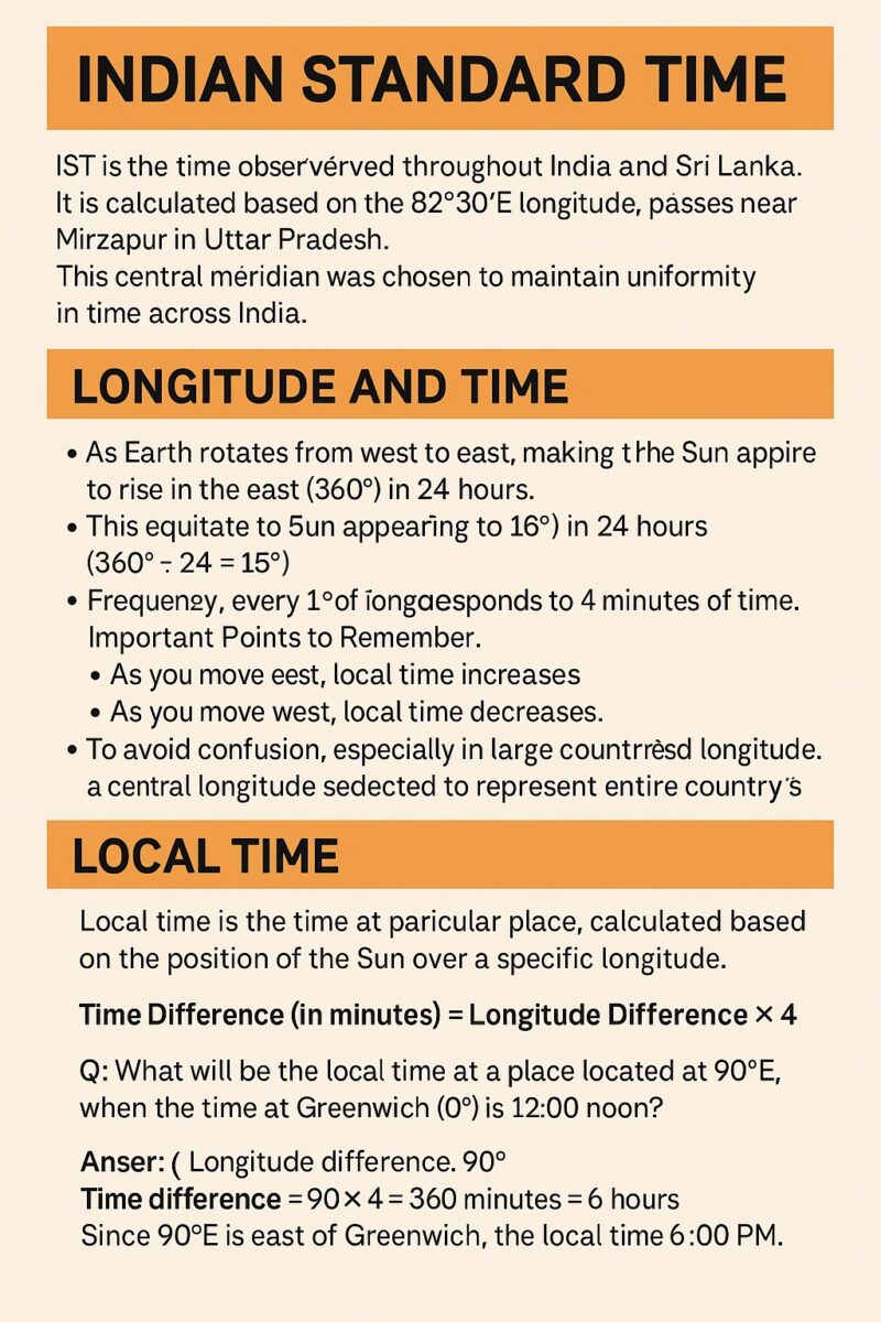
Indian Standard Time, also known as IST, is the official time observed throughout India. It is calculated based on the standard meridian of India, which is 82°30’E longitude. This Indian Standard Time Meridian passes near Mirzapur in Uttar Pradesh.
As per international timekeeping, IST of India is +5:30 hours ahead of Greenwich Mean Time (GMT) or the Greenwich Meridian. This makes the Indian Standard Meridian unique compared to other countries that follow full-hour time zones.
The clock tower in Mirzapur near Allahabad, Uttar Pradesh, is approximately on the corresponding longitude reference line, and Indian Standard Time is calculated on the basis of 82.3 degrees east longitude. Thus, Indian standard time (IST) refers to the local time of Mirzapur near Allahabad.
In India, the sun rises nearly two hours earlier in the northeast (Arunachal Pradesh) than in the west (Gujarat). This means that people in the east start their day in the dark, and their work hours extend well past sunset. This can disrupt sleep patterns and overall health.
Longitude and Time
Time zones across the globe are derived from the longitude system of the Earth. The Earth is divided into 360° of longitude, and it rotates from west to east, completing one full rotation in 24 hours. This rotation creates the effect of sunrise in the east and sunset in the west.
- There are 180° of longitude both east and west of the Prime Meridian (0°).
- The sun moves across 15° of longitude per hour, meaning 1° of longitude = 4 minutes.
- Thus, as we move eastward, the time increases, and as we move westward, it decreases.
Local Time
Local Time refers to the time observed at a particular location, depending on its longitude. It is calculated with respect to the Greenwich Meridian (0°) and the longitude of the location.
The misalignment of official time with natural daylight leads to wasted daylight hours in the morning and an increased reliance on artificial lighting in the evening. Studies in India have shown that adopting two time zones could lead to significant energy savings. Some regions, like the tea gardens of Assam, have even adopted an unofficial “Chaibagaan time” that is one hour ahead of IST to better utilise daylight.
Example for UPSC Aspirants:
If a place lies at 90° East, what would be the local time when it’s 12:00 noon at Greenwich?
- Difference in Longitude = 90°
- Time Difference = 90 × 4 = 360 minutes = 6 hours
- Local Time = 12:00 noon + 6 hours = 6:00 PM
As the place is east of Greenwich, it adds to GMT. If it were west, we would subtract.
Indian Standard Meridian
To ensure a uniform standard time across the country, countries adopt a Standard Meridian. This is usually a longitude that is a multiple of 7°30’ or 15°, making it easy to express time differences with GMT in whole or half hours. The discrepancy between official time and the sun’s position can lead to a loss of productivity, as people’s natural biological clocks are not in sync with their work schedules.
India’s Standard Meridian:
- The Standard Meridian of India is 82°30’E.
- It is called the Indian Standard Meridian, and IST is based on this longitude.
- This Indian Standard Longitude passes near Mirzapur, not exactly through the centre, but close enough to serve national standard time purposes.
This meridian is commonly referred to in exams like UPSC as Indian Standard Time Meridian or India Standard Time Meridian.
| Feature | Greenwich Mean Time (GMT/UTC) | Indian Standard Time (IST) |
| Reference Longitude | 0° (Prime Meridian) | 82° 30′ E (Standard Meridian) |
| Time Offset | +0:00 Hours | +5:30 Hours |
| Location Basis | Royal Observatory, London | Mirzapur, Uttar Pradesh |
| Calculation | Base Reference | 82.5° × 4 minutes per degree |
| Current Status | Global Standard | India’s Single Time Zone |
Time Zones and India’s Extent
Although India’s geographical extent spans nearly 30 degrees in longitude (from ~68°E to ~97°E), it follows only one time zone – IST.
- Unlike Russia (11 time zones), the USA (6), and Canada (6), India and China maintain a single time zone to avoid administrative complications.
The Indian standard time line in India, and the line passes through which states
Indian standard time line in India is crucial because it serves as the reference meridian for calculating the single time zone used across all of India. The local time at this meridian is considered the standard for the entire country.
The Indian Standard Time line passes through five states:
- Uttar Pradesh: The IST meridian is famously recognised for passing through the city of Mirzapur (and nearby Allahabad/Prayagraj), which is often cited as the reference point for calculating.
- Madhya Pradesh: The line crosses the state, influencing its timekeeping.
- Chhattisgarh: The meridian passes through the eastern part of the state.
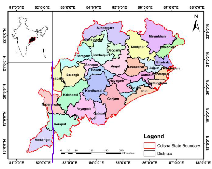
- Odisha: The IST line runs through a significant portion of Odisha. The Districts through which it moves in Odisha are: Nuapada, Nabarangpur, Koraput, and Malkangiri.
5.Andhra Pradesh: The meridian passes through the southeastern part of Andhra Pradesh.
Using a single standard time zone helps to ensure uniformity and avoid confusion in daily activities, such as railway and flight schedules, despite the country’s vast longitudinal extent.
In the USA and Canada, the time zones often align with states and provinces, which have a high degree of autonomy. This makes it easier for different regions to manage their own economies and social schedules. For example, the business day on the West Coast can overlap with part of the business day on the East Coast, facilitating commerce.
Conclusion
To summarize:
- Indian Standard Time is calculated from the 82°30’E meridian.
- It is +5:30 hours ahead of GMT.
- The IST meridian passes through India, near Mirzapur, and is vital for national synchronisation.
- This single-zone approach, despite India’s vast extent, is a unique administrative decision.
- Understanding the Indian meridian, IST, and the Greenwich Meridian in India is crucial for geography, general awareness, and UPSC preparation.
Also, check the International Date Line
References