
India Structure and Physiography
The Northward movement of the Indian plate is still continuing and has significant consequences on the physical environment of the Indian subcontinent.
The movement of the plate is primarily because of endogenic and exogenic forces and lateral movement of the plates present geological structure and geomorphologic processes that are active in the Indian subcontinent.
India can be divided into three geological divisions such as Penisular Block, Himalayas, and other Peninsular Mountains, Indo-Ganga-Brahmaputra Plain.
The Peninsular Block
The northern boundary of the Peninsular Block may be taken as an irregular line running from Kachchh along the western flank of the Aravali Range near Delhi and then roughly parallel to the Yamuna and Ganga as far as the Rajmahal Hills and the Ganga delta.
Apart from these, the Karbi Anglong and the Meghalaya Plateau in the northeast and Rajasthan in the west are also an extension of this block.
The northeastern parts are separated by the Malda fault in West Bengal from the Chotanagpur plateau.
In Rajasthan, the desert and other desert-like features overlay this block.
The Peninsula is formed essentially by a great complex of very ancient gneisses and granites, which constitutes a major part.
Since the Cambrian period, the peninsula has been standing like a rigid block with the exception of some of its western coasts which is submerged beneath the sea and some other parts changed due to tectonic activity without affecting the basement.
As a part of the Indo-Australian plate, it has been subjected to various vertical movements and block faulting.
The rift valleys of the Narmada, the Tapi and the Mahanadi and the Satpura block mountains are some examples.
The Peninsula mostly consists of relict and residual mountains like the Aravali Hills, the Nallamala Hills, the Javadi Hills, the Veliconda Hills, the Palkonda Range, and the Mahendragiri Hills, etc.
The River valleys shown here are shallow with low gradients.
Most of the east-flowing rivers form deltas before entering into the Bay of Bengal.
The deltas formed by Mahanadi, Krishna, Kaveri, and Godavari are good examples.
The Himalayas and other Peninsular Mountains
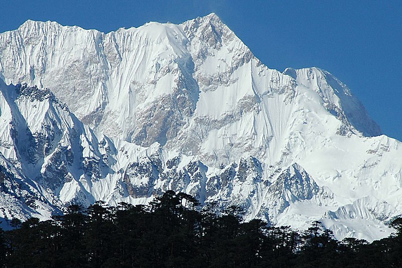
The Himalayas and other Peninsular mountains are young, weak, and flexible in their geological structure, unlike the rigid and stable Peninsular Block.
These mountains are tectonic in origin, dissected by fast-flowing rivers that are in their young stage.
Various landforms like gorges, V-Shaped Valleys, Rapids, Waterfall, etc are indicative of this stage.
Indo-Ganga-Brahmaputra Plain
The third geological division of India comprises the plains formed by the river Indus, the Ganga, and the Brahmaputra.
Originally, it was geo-synclinal depression that reached maximum development during the third phase of the Himalayan mountain formation approximately about 64 million years ago.
Since then, it is gradually filled by the sediments brought by the Himalayan and Peninsular rivers.
The average depth of alluvial deposits in these plains ranges from 1000-2000 meters.
Physiography of India
Physiography of an area is the result of the structure, process, and stage of development.
India can be divided into the following physiographic divisions as The Northern and North-eastern Mountains, the Northern Plain, the Peninsular Plateau, Indian Desert, Coastal Plains, and Islands.
North and Northeastern Mountains
The north and northeastern mountains consist of the Himalayas and the northeastern hills.
The Himalayas consist of a series of parallel mountain ranges.
Some of the important ranges are the Greater Himalayan Range that including the great Himalayas and Shiwalik.
The general orientation of these ranges is from northwest to the southeast direction in the northwestern part of India.
The Himalayas in the Darjiling and Sikkim regions lie in an east-west direction, while in Arunachal Pradesh they are from southwest to north-south direction.
The approximate length of the Great Himalayan range, also known as the central axial range is 2500 km from east to west and their width varies between 160 to 400 km from north to south.
The Himalayas are not only the physical barrier but also climatic, drainage, and cultural divide.
On the basis of relief, alignment of ranges, and other geomorphological features, the Himalayas are divided into Kashmir or Northwestern Himalayas, Himachal, and Uttarakhand Himalayas, Darjiling, and Sikkim Himalayas, Arunachal Himalayas, and Eastern Hills and Mountains.