The erosional landforms of the river are River Valley Formation, Potholes and Plunge Pools, Incised or Entrenched Meanders, River Terraces, etc.
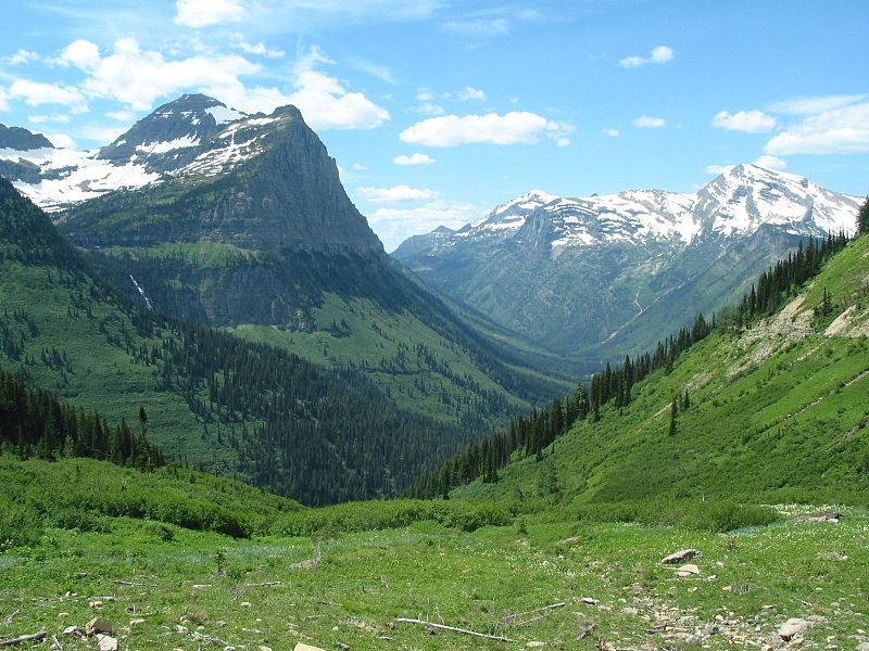
Valleys
The valley begins as small and narrow rills. The rills then slowly develop into long and wide gullies. Then the gullies get deepened, widened, and rise on becoming valleys.
Based on the dimensions and shape, the Valleys are classified as V-Shaped Valleys, Gorges, Canyons, etc.

V-Shaped Valleys
The V-Shaped Valley is formed by the river erosion over time and its shape is similar to the letter “V“.
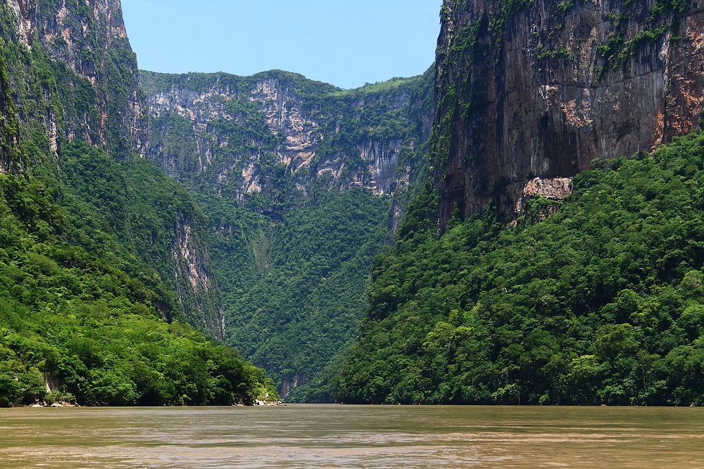
Gorge
A Gorge is a narrow, deep valley running between the mountains or hills with very steep to straight sides. It is typically with steep rocky walls and rivers or streams running through it. Also, the canyon is characterized by steep step-like side slopes and might be as deep as the gorge.
It is almost equal in width at the top and as well the bottom. On the other hand, the Canyon is wide at the top than its bottom. Also, the fact, is that Canyon is a type of Gorge.

The valley depends on the structure and types of rock on which they form due to the erosion by running water.
For Example – Gorges are formed in Hard rocks and Canyons are formed in the horizontal bedded sedimentary rocks.
Potholes and Plunge Pools
Over the rocky beds of hill-streams, circular depressions called potholes form because of stream erosion aided by the abrasion of rock fragments. Once a small and shallow depression forms, pebbles and boulders get collected in those depressions and get rotated by flowing water and consequently the depressions grow in dimensions.
A series of such depressions eventually join and the stream valley gets deepened. At the foot of waterfalls also, large potholes, quite deep and wide, form because of the sheer impact of water and rotation of boulders.
Such large and deep holes at the base of waterfalls are called plunge pools. These pools also help in the deepening of valleys. Waterfalls are also transitory like any other landform and will recede gradually and bring the floor of the valley above waterfalls to the level below.
Incised or Entrenched Meanders
In streams that flow rapidly over steep gradients, normally erosion is concentrated on the bottom of the stream channel. Also, in the case of steep gradient streams, lateral erosion on the sides of the valleys is not much when compared to the streams flowing on low and gentle slopes.
Because of active lateral erosion, streams flowing over gentle slopes, develop sinuous or meandering courses. It is common to find meandering courses over floodplains and delta plains where stream gradients are very gentle.
But very deep and wide meanders can also be found cut in hard rocks. Such meanders are called incised or entrenched meanders.
Meander loops develop over original gentle surfaces in the initial stages of development of streams and the same loops get entrenched into the rocks normally due to erosion or slow, continued uplift of the land over which they start.
They widen and deepen over time and can be found as deep gorges and canyons in hard rock areas. They give an indication of the status of the original land surfaces over which streams have developed.
River Terraces
River terraces are surfaces marking old valley floor or floodplain levels. They may be bedrock surfaces without any alluvial cover or alluvial terraces consisting of stream deposits.
River terraces are basically products of erosion as they result due to vertical erosion by the stream into its own depositional floodplain.
There can be a number of such terraces at different heights indicating former river bed levels. The river terraces may occur at the same elevation on either side of the rivers in which case they are called paired terraces. When a terrace is present only on one side of the stream and with none on the other side or one at quite a different elevation on the other side, the terraces are called unpaired terraces.
Unpaired terraces are typical in areas of slow uplift of land or where the water column changes are not uniform along both the banks.
The terraces may result due to:
(i) receding water after a peak flow
(ii) change in hydrological regime due to climatic changes;
(iii) tectonic uplift of land;
(iv) sea-level changes in the case of rivers closer to the sea.